By Van Smith
Published by City Paper, May 21, 2003
It’s one of my fondest childhood memories: my mom, myself, my sisters, and our pets (a dog, a hamster, a guinea pig, and a mouse) packed into a station wagon, doing the long haul up the East Coast during summer vacation. We called it “getting lost”–purposefully taking random exits off of Interstate 95, armed with a good map, in search of obscure, out-of-the-way places.
A riverside picnic spot off the beaten path, an ancient barn crowned with an interesting weather vane, a crafts co-op run by back-to-nature hippies–where we were headed (and we often didn’t know exactly where) was less important than the route taken. The main idea was to have the weighted-down wagon’s tires meet asphalt or dirt they had never before touched, taking us through landscapes we’d never before seen. Sometimes it seemed like a treasure hunt, with the arrival at one destination bringing clues to the next.
The Eastern Shore, with its vast, flat expanses of storied territory, offers excellent possibilities for getting lost. The hinterlands between and beyond Route 50 and Route 404 are often bypassed by the fun-seeking hordes en route to the ocean. Leaving the shore traffic behind to hit sleepy towns and dusty roads makes for prime back-roading. It helps to have guideposts to seek, and Delmarva’s Maryland-Delaware border is lined with just the thing: stone markers, first laid down in the 1760s by British surveyors Charles Mason and Jeremiah Dixon.
According to Roger Nathan, a New Jersey resident whose book East of the Mason-Dixon Line (Delaware Heritage Press, 2000) describes the making of Delaware’s borders, the 3 1/2-foot-high English limestone monuments were placed at every mile point along the line during two weeks around the Christmas of 1765. Many have disappeared, either sunk into marshland or removed, and many that remain are damaged. There are still plenty to find, however, and looking for them makes for a DIY tour of a slice of Delmarva that few tourists ever see.
The Mason-Dixon Line, the world-famous boundary between Maryland and Pennsylvania, defined the geography of this country’s mid-19th-century political conflict over slavery, culminating in the Civil War. Mason and Dixon undertook their celebrated survey between 1763 and ’68, in order to settle a nearly century-long property dispute between the Penns of Pennsylvania and the Calverts of Maryland. What today we call the Mason-Dixon Line, though, was but one part of Mason’s and Dixon’s task. Back then, this latitudinal boundary was called the “West Line” and was started only after the English surveyors completed the “Tangent Line”–the north-south line that now marks the Maryland-Delaware border.
The Tangent Line starts at the “Middle Point,” which falls between Mardela Springs, Md., and Delmar–a town that straddles the Maryland-Delaware border–and is the center of the “Transpeninsular Line,” the east-west line that marks the southern Maryland-Delaware border, which runs from the Atlantic coast near Fenwick Island, Del., to the Chesapeake Bay. From the Middle Point, Mason and Dixon in the summer of 1764 chained 82 miles northward, through farms, marshland, and forests, to touch the 12-mile arc they had drawn around New Castle, Del.
Before starting out on this stone-seeking tour, some reading and references are in order. Nathan’s book is concise with the particulars, giving photos and rough descriptions of the markers and their locations, along with accounts of the surveyors’ charge and challenges. But it also a good idea to chase down a copy of The Journal of Charles Mason and Jeremiah Dixon (American Philosophical Society, 1969; out of print) to let the men tell their own story, although as men of science, their entries are frustratingly stark. To round out the picture, Thomas Pynchon’s novel Mason & Dixon (Henry Holt, 1997), intimidatingly thick at nearly 800 pages, provides a fantastical glimpse of the surveyors’ characters and the Age of Reason’s hellbent pursuit of all things knowable.
Lastly, but most importantly, get some good maps. Delorme’s Maryland-Delaware Atlas and Gazetteer is invaluable for modern-day explorers, but even better detail is available from Maryland Geological Survey topographic maps of Wicomico, Dorchester, Caroline, Queen Anne’s, Kent, and Cecil counties.
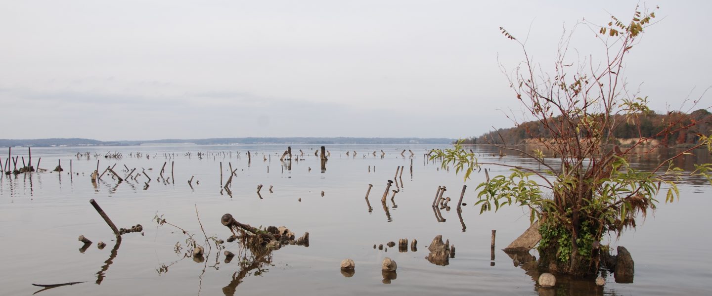
Nearly all of the existing, accessible Mason-Dixon markers can by found by land travel, but somewhere under the marshy north bank of the Nanticoke River is the long-submerged seven-mile marker, regained only via water. To get there, intrepid stone searchers can put their watercraft in at the public boat ramp at Sharptown, Md., on the south side of Route 313’s Nanticoke River bridge.
The river here is wide and tidal, and the two-mile trip to the boundary is likely to be attended by ospreys, herons, perhaps a bald eagle, and plenty of fish a-jumpin’. The spot itself is somewhat anticlimactic, as no stone can be found, but the boundary is marked by a signpost and metal National Geodetic Survey markers alerting passersby to the nearby presence of the submerged marker. Just upriver from the signpost is tiny Wright Creek, a relaxing side trip for canoeists or kayakers, taking paddlers through a meandering, marshy waterway that is home to an abundance of turtles and alive with trout.
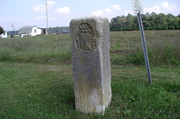
A car tour of the markers is best started at the Middle Point, a short distance off Route 50 on Route 54. Protected in a gated pavilion are three stones. The Middle Point monument is a crownstone, so-called because it bears the coats of arms of the Penns on the Delaware side and of the Calverts on the Maryland side, as do other existing crownstones at five-mile intervals along the Tangent Line. (The crownstone pictured above is near Greensboro, Md.) The other two stones at the Middle Point pavilion, Nathan told me before our trip, are the 25-mile marker of the Transpeninsular Line and a stone of no historical significance, set by a local resident.
Gazing north from the Middle Point pavilion, you’re all set to look for more Mason-Dixon stones, with one important catch: Many of the stones are on private property, and thus not available for viewing without permission from the property owners.
On the outskirts of Sharptown is the former site of marker No. 5–a crownstone that Nathan reports has been missing since 1999. Locals pointed us to the location, along a dirt road that follows the border, with fields on the Maryland side and woods on the Delaware side. The National Geodetic Survey markers there–small metal signs on posts–have been nearly destroyed by short-range shotgun blasts, perhaps a sign of local hostility to government totems.
As we scuffed around the area where marker No. 5 used to be, a man travelling in the local fashion–that is, wearing a timeworn baseball cap advertising agricultural products and driving an old pickup truck–pulled over next to us. “You fellers studying the Mason-Dixon Line?” he asked, friendly as can be. When we confirmed we were, he added, “You know, they resurveyed the line using laser beams a few years back, and those fellers had it right on the money.” And then he headed off down the road, leaving us in a cloud of dust. We were unable to confirm the use of laser beams in conducting the resurvey, but he was right: In 1978, a coalition of government agencies checked Mason and Dixon’s work and found it utterly accurate.
The next stop is the nine-mile marker, just north of Galestown, Md., en route to Reliance, Md.–where the house of Patty Cannon, infamous for kidnapping freed slaves in Delaware and reselling them to Maryland slave owners in the early 1800s, is commemorated with an historic plaque. Transgressing in our own small way, we skirted around a private home along a field to take a look at the stone, which has an m carved on the Maryland side and a p on the Delaware side, referring to that state’s colonial origins as part of the Penns’ land grant.
The 15-mile marker is a well-preserved and easily accessible crownstone on the east side of Route 549 near Oak Grove, Del. Here we began to detect a land-use pattern where the state border also delineated different zoning–in this case, farming on the Delaware side, woods and homes on the Maryland side. Then, on to the 17-mile marker, located just north of Route 318 in the middle of a hay field near tiny Atlanta, Del. The stone carver goofed on this one, Nathan speculates, as the Delaware side has a “p” carved over an “m”–making it the Mason-Dixon stone hunter’s equivalent of a philatelist’s Three Skilling Yellow Banco, the world’s most valuable stamp due to a printing error.
As we moved northward, we grew more adept at finding stones–and also noted that the towns and villages north of Route 404, a major highway, grew increasingly lost in time. No Wal-Marts, no McDonald’s, no malls to undermine the old village general-store-and-a-post-office economy that probably hasn’t changed much since the advent of railroading. Naming towns–Schultie Crossroads, Melvin Crossroads, Ringgold’s Green–was a simple matter of connecting family names with a description of the locale.
A daring close to our tour is a climb up a high and frail tower at the state border on Route 404, about 25 miles north of the Middle Point. The tower was built to commemorate the 1978 resurveying of the Mason-Dixon Line. Apparently unmaintained since it was constructed, the tower features rotted pine steps and rickety Tinkertoy engineering. The fence gate at its base, meant to keep the public out, is off its hinges, so temptation got the best of us–despite a dire warning from a kid who lives next door, whose brother, he said, almost fell through the tower’s weather-beaten steps the last time he climbed it. Gripping the metal rails and stepping carefully to avoid weak spots, though, we managed to gain a high vantage point.
The risk was worth it, if only to see Delmarva’s Mason-Dixon Line as Mason and Dixon never could: from above, with miles and miles of Eastern Shore vista spread out all around us. Traveling through this new-to-us territory, and then seeing it from above, serves to drive home the marvel of their surveying feat–and the value of getting lost.
