Law of the Land: Maryland General Assembly works to restore weakened Critical Areas Act

By Van Smith

Published in City Paper, March 31, 2004

Shortly after Tropical Storm Isabel’s floodwaters hit the Chesapeake Bay shoreline last fall, carrying away chunks of waterfront land and destroying vast sums of bay-side investments, the Maryland Court of Appeals relaxed key provisions of a 20-year-old law restricting development within 1,000 feet of the water (“Time and Tide,” Oct. 22). Backers of the Critical Areas Act of 1984 assaulted the court’s opinion and argued that the law had slowed the pace of coastal construction for nearly a generation, and thus, by constraining new development where storms exact the heaviest tolls, had prevented further losses from Isabel. But the judges’ blow to the law, coming from the state’s highest court, was final. The job of straightening its spine now falls to members of the Maryland General Assembly, who are now attempting to trump the court’s move with legislation to restore the law to its original ecologically protective intent.

The Critical Areas Act, which bans new construction within a 100-foot buffer zone closest to bay waters and curtails it in specified areas within a 1,000-foot strip, is overseen by the state Critical Areas Commission for the Chesapeake and Atlantic Coastal Bays. The commission’s chairman, former Republican state Sen. Martin Madden, was sworn in less than a year ago and immediately alerted lawmakers of his hope to firm up the act’s enforcement provisions. Then came Lewis v. Department of Natural Resources, a case before the high court in which Edwin Lewis, an apparel-industry executive, belatedly sought permission to build a hunting lodge and cabins on a tidewater hummock he owns in Wicomico County. By the time Lewis had applied in 2000 for a county variance to build on his site, which is in the critical-areas buffer zone, construction had already started.

The seven-member court’s 4-3 decision relieved Lewis, and therefore other landowners in the critical areas, of the burden to prove that their proposed building projects won’t harm the bay. Instead, local governments now have to show that such projects would harm the bay. That’s a tall order for governments to fill, say Madden and others who criticized the court ruling. Asking cash-strapped counties to prove the harm caused by each proposed project in the critical areas, Madden says, would effectively undermine the law’s intended goal of protecting the shoreline from damaging development. To make matters worse, the decision condoned Lewis’ course of action: build first, seek permission later, then claim the remedy–the removal of illegally built structures–is an undue hardship.

“The ruling turned everything on its ear,” says Dru Schmidt-Perkins, executive director of the 1,000 Friends of Maryland, a nonprofit coalition that advocates environmentally sound growth. “Twenty years ago, when the law passed, we said, ‘We all agreed that we’re going to protect this fragile shoreline,’ but now we have to come back and re-establish the intent of the law. I find that extraordinary.”

In the decision’s aftermath, Madden, like the many homeowners repairing post-Isabel wreckage, set about patching up the court’s blows to the Critical Areas Act. He has been working his persuasive magic on his former colleagues in the state legislature, and his efforts appear to be paying off: The legislation, introduced this session, is moving through the General Assembly process at a brisk pace with little controversy or fanfare.

“The main bill basically brings us back to where we were prior to Lewis,” Madden says. It clarifies the law’s overall intent to protect the bay and plugs the holes shot through the law by the Lewis decision. It also increases penalties–from the existing maximum of $500, to a proposed $10,000–for violations. And it gives local governments the option of asking the state Critical Areas Commission to handle tough enforcement cases. The measure was supported by a broad array of interests–everyone from realtors and builders to the Chesapeake Bay Foundation and the Maryland Association of Counties–and passed, 41-6, in the Senate on March 22. The House will consider the bill after a hearing scheduled for April 2.

“It was agreed by everyone that we needed to go back” to the law’s pre-Lewis strength, says lobbyist Bill Castelli, of the Maryland Association of Realtors. “[But] everybody needed to get comfortable that the bill wouldn’t go beyond that.”

A comfortable consensus was reached, Castelli adds, after a few, minor clarifying amendments were added. Still, he points out a cautionary note about future litigation over a restored Critical Areas Act: “You just can’t predict what will and won’t get challenged in court.”

Time and Tide: Will the erosion of Maryland’s Critical Areas Act mean even bigger trouble when the next Isabel comes along?

By Van Smith

Published in City Paper, Oct. 22, 2003

Tropical Storm Isabel’s short visit exacted a pricey tribute on the Baltimore region’s shoreline. Thousands of homes were damaged and hundreds destroyed in Baltimore and Anne Arundel counties. Well water in many low-lying communities remains contaminated from the polluted floodwaters. Piers, boats, and boat-lifts were battered, broken, or carried away, while sea walls failed in some places, allowing Isabel to scour away chunks of earth from people’s properties. Bethlehem Steel’s Sparrows Point facility lost its multimillion-dollar power plant and had to close down production for six days. An Anne Arundel sewage-treatment plant also lost power, sending a hefty dose of untreated waste into Cox Creek near the city line. Baltimore City’s tourist-drawing waterfront choked on inventory losses, building damage, and missed business from Isabel’s historic tidal flood, which here and there breached the 100-year flood line. In all of Maryland, estimates of total losses from Isabel are in the hundreds of millions of dollars and climbing.

Given Isabel’s high cost and human suffering, it seems almost quaint to survey her effects on Baltimore County’s North Point State Park, a 1,300-acre tract of marsh, woodlands, fields, and bay-side frontage on the Dundalk peninsula between the Patapsco and Back rivers. But Steve Takos Sr., at 80 and after five surgeries in the past eight months, has good reason to visit on this sunny October afternoon. He first came here in 1937 as a duckpin-setter for a nickel a game, and later took tickets for amusement rides. That’s when it was Bay Shore Park, a resort on a trolley line that drew throngs from around the region to play on the water. One way or another, Takos has been working here ever since. When Beth Steel owned the property from 1946 to 1987, he served as a guide for Sparrows Point executives on lunch-hour hunting and fishing trips. Today, he’s a volunteer park ranger. His long past with the property now compels him to see how it fared in the flood.

“Holy Moses! I’ve never seen it this bad,” Takos exclaims as he stands at the foot of Ferry Grove Pier, where a cluster of waterfront buildings once sat, receiving visitors and trade from the Eastern Shore. Isabel tossed around the scattered remnants of the long-gone structures like so many grains of sand, creating high dunes of rock, brick, and Belgian block stretching back into the woods. Nestled among the mounds are hefty chunks from the shattered sea wall and pier, a section of which collapsed in a jumbled mass of cement and twisted rebar. “Thousand-pound boulders were just picked up and thrown” by the wind-driven waves, Takos marvels, adding that “this may have been worse than the storm of 1933,” which tore down the trolley line’s trestle bridge over nearby Shallow Creek.

Takos has already checked out the pounding the 1,000-foot-long fishing pier took (it’s closed indefinitely) and how storm-driven flotsam knocked the support posts of the restored trolley house out of whack. But he’s mystified by what he finds further up the park’s shoreline. Large trees toppled over a retreating bluff onto a newly expanded beach, where roughly 30 yards of high ground fell into the bay. A butte of sandy earth topped with grass and stones, eight feet high and five feet in diameter, was left standing like a sentry on the gouged-out shore. At its foot, a segment of old “corduroy road” was excavated by the bay’s storm-churned waters. Constructed of large timbers set side by side, the road served mule-drawn carts bringing building materials for the Bay Shore trolley line a century ago but has been buried for decades. The sudden reappearance of the corduroy road pleases Takos: “That’s one good thing [Isabel] did. I always said the tracks ran right through here, and there they are.”

He points to where a drowned section of Bay Shore’s sea wall pokes up through the tide a hundred or so yards offshore. Once a stout, six-mile-long barrier, he explains, the wall has since become an increasingly fragmented line of broken cement and rocks that here descends into open water, forming a shallow bay behind it. “There was all high land up to that sea wall,” he remarks while standing on the edge of the bluff. “Lost all of it in 60 years.” Takos has been around over the decades to watch firsthand as the bay swallowed up the land here. With Isabel’s help, it took another big bite.

The day after Takos’ visit to the park, on Oct. 10, a storm of another sort came down from the state’s highest court and took a bite out of the law designed to protect the bay’s shoreline. The 1984 Critical Areas Act governs development in almost 700,000 acres within a 1,000-foot strip around the Chesapeake Bay’s Maryland shoreline and virtually bans new construction inside a 100-foot buffer zone closest to the water–the so-called “critical areas” where new construction is reviewed, guided, and in some cases stopped altogether. In its final word on the case of Lewis vs. Department of Natural Resources, the seven-member Court of Appeals declined to reconsider a July decision that the three dissenting judges say hobbled the act. Unless the state legislature repairs the damage to the law–and it is expected to try in the coming session that starts in January–planning boards in the 16 bay-side counties and 45 municipalities affected by it can expect to see property owners try to exploit the Court of Appeals decision with new building proposals. Already, “it’s seeping into arguments that we are hearing on the local levels,” says Martin Madden, a former Republican state senator from Howard County who in late spring was named chair of the Critical Areas Commission charged with implementing the law.

North Point State Park’s eroding waterfront has a lesson to teach about the Critical Areas Act: Government may try to legislate development along the shore front, but nature bats last. Scientists expect the coming decades to bring more frequent and stronger storms for the Mid-Atlantic, as the bay rises in step with global sea-level rises. If the experts are right, North Point’s history serves as a graphic harbinger of what ultimately can happen to shoreline development: buildings and piers smashed by the sea, once solid ground eaten away and reclaimed by flooding and erosion. By paving the way for more bay-side development, the Appeals Court’s decision on Lewis virtually assures that more property owners will face those inexorable natural forces in the future, likely losing homes, improvements, and raw acreage in the bargain.

“The [Critical Areas] Act says it’s good to move people out of that buffer area for the bay’s sake,” says J. Court Stevenson, an ecologist and sea-level rise expert at the University of Maryland Center for Environmental Sciences near Cambridge. The law, he points out, theoretically gives the Chesapeake more of a chance to rebound from its various environmental ills by discouraging human activity directly on its shoreline. But, he adds, rising seas and violent storms “show that it’s also good to move people out of the buffer for people’s sake.”

Crafting a passable critical-areas bill back in 1984 meant pulling a few of its teeth. Thousands of undeveloped parcels were legally partitioned into buildable lots before the law took effect and grandfathered in, Madden and the Critical Areas Commission’s executive director, Ren Serey, explain in an interview, but there is no way to estimate how many or their combined acreage. And the law designates 5 percent of land as a “resource conservation area,” subject to a low development density of one dwelling per 20 acres, to be reclassified by local planning boards in a “growth allocation” process to allow more intense uses. The law’s untapped–and largely unknown–potential for future shoreline development is enormous. The only way to slow that growth is for legislators to change the law.

The law’s built-in weaknesses are the source of much browbeating from people who expected it to have done more to rein in waterfront development as its second decade begins. State Del. Joan Cadden, an Anne Arundel County Democrat and member of the General Assembly’s joint Committee on Chesapeake Bay Critical Areas, voiced this sentiment with great frustration at a July 7 committee hearing: “How do we allow them to do these things? I thought that’s what we were all about, making sure that kind of development didn’t happen anymore. I thought that is what we were here for.”

“You all need to get some teeth,” chided Calvert County Democrat Del. George Owings III at the hearing. He told the story of how novelist Tom Clancy cleared a wide swath of trees down to the waterfront of his Calvert County property, “and got a tiny little fine.” “Just pay the fine and take the view, that’s what’s happening here,” Owings said.

Madden had an answer to that. “Enforcement is spotty, inconsistent, and deteriorating,” he told the joint committee. “It’s easier [for property owners] to pay a $500 fine and freely develop the property.” His solution: “We will probably look for penalties in the area of $10,000 instead of $500. We will also work to allow the local governments to refer to the commission on a voluntary basis a violation that they feel maybe they just don’t have the ability to handle because they are overwhelmed with other issues.” Madden also pointed out that the commission has no powers to strengthen its rules or enforcement powers: “The legislature has to do that.”

Madden didn’t have an answer to a big-picture gripe from the committee’s co-chair, state Sen. Roy Dyson, a Southern Maryland Democrat: “The truth of the matter is, what has happened with the bay cleanup is that it has stalled. Million-dollar homeowners support the bay cleanup without understanding their own contributions to the problem.”

The contributions Dyson referred to are actually codified as “findings” in the critical-areas act, making it a matter of law in Maryland that human activities like building and tree-clearing and their cumulative effects harm the bay, while minimizing such activity aids in the bay’s restoration. But Dyson’s allegation of hypocrisy among wealthy waterfront property owners underscores one of the law’s most noticeable impacts: rising property values in the critical areas.

The ink had hardly dried from then-Gov. Harry Hughes’ pen before the land rush started on properties within its yet-to-be-drawn border. Prices started going up immediately, and they’ve never stopped. As a result, wealthier people have been supplanting middle-class waterfront owners. “McMansions are springing up where bungalows used to be,” an Anne Arundel County planner puts it. With the monied property owners come lawyers. From 1984 until 1999, the Critical Areas Act went largely unhindered by adverse court decisions. Then, before the Lewis decision came down, three cases hit the Court of Appeals in succession, and the unanimous rulings of the court knocked open loopholes for more development. As a result, the General Assembly in 2002 revisited and strengthened the act.

Enter Edwin Lewis and his lawyer, Raymond Smethurst Jr. of Salisbury. Working for apparel-industry giants Tommy Hilfiger and Polo Ralph Lauren had been good to Lewis, an avid hunter who’s long enjoyed the Eastern Shore at his waterfront estate. In 1999 he added to his idyllic holdings, buying up nearly 300 acres of Wicomico County marshland. In the middle of it is a five-acre hummock, a rise in the marsh with trees growing on it, where in early 2000 Lewis proceeded to build a hunting lodge, four cabins, and a shed–all of it without permits and all of it inside the 100-foot critical area buffer zone.

Construction was almost over before anyone noticed. Once the authorities caught up with Lewis, Smethurst stepped in, bringing his experience working for those accused on the Eastern Shore of breaking land-use laws. Lewis didn’t purposefully break the critical-area rules, Smethurst explained. Then Lewis sought a zoning variance to allow the lodge and one cabin to remain in the buffer area. When it was denied, Lewis had Smethurst appeal it all the way up to the top–and won, because the court ruled there wasn’t sufficient evidence to show the project harmed the environment.

To Ren Serey, who’s been the executive director of the Critical Areas Commission since 1995, the Lewis ruling was a serious blow both to the commission and to zoning laws generally in Maryland. First off, he explains, it shifted the burden of proof from the property owner to the government in assessing the potential harm a project may cause. Thus, instead of requiring property owners to show local planning boards why their projects would not cause harm, it’s now up to the government to show why the project would cause harm. “That’s new,” says Serey, “and in our viewpoint, a significant burden on local government, both in and outside the critical areas, because now they, not the applicant, have to prove the question of harm.”

The ruling also flouted “the self-imposed hardship rule,” Serey argues. Now, the fact that something has already been built without permits, and that the remedy–removing the structure–would be a “self-imposed hardship,” can be used to argue that it should be allowed to stay. “The court even said,” Serey continues, “that the fact that Mr. Lewis actually started constructing these cabins benefited everybody because he could use their construction to prove that he wasn’t causing harm.” Finally, Serey contends that the court overlooked the findings of the legislature about the cumulative human impacts that harm the bay.

Appeals Court Judge Alan Wilner minced no words in his dissenting opinion on the Lewis case, in which he was joined by two other judges. “This was not just a disagreement over a point of law,” he writes of the 4-3 ruling. “In my view . . . the majority Opinion was deliberately designed, and, unless the General Assembly acts swiftly and decisively, may be effective, not only to dismantle the critical areas program but to seriously weaken fundamental zoning and land use controls generally.” Wilner further wrote that the decision was as “an invitation to the very kind of lawless behavior that occurred in this case–ignore the law, destroy the habitat and build where the law does not permit, do it all in secret, and then claim hardship.”

The majority opinion on Lewis plays down the case’s broader impact. But within days after the Lewis decision came down on July 31, Madden recalls, “we had a hearing in Anne Arundel County where a local zoning examiner had a complaint by some neighbors that a person was building their house much larger than had previously existed within the sensitive buffer area. And it was pointed out that this person had already built it, so to tear it down would be a big inconvenience, but it is a self-imposed hardship, so be it. And the hearing examiner made the comment that, ‘Well, until three days ago, I would have thought that was the case.’ I suspect we’re going to hear a lot more of that.”

The build-first, ask-questions-later mentality is alive and well along the bay. Serey doesn’t know the total number of violations found annually, but says construction without permits is a regular occurrence and that they are usually discovered after a neighbor complains. If the Lewis ruling ends up encouraging lawlessness, as Judge Wilner predicts, and if the fines imposed for breaking the act aren’t increased, the mentality is likely to bloom, resulting in even greater investment in bay-side improvements. To Court Stevenson, the University of Maryland sea-level expert, the whole trend is ass-backward.

Stevenson is standing on what he thinks may be one of the highest points in Dorchester County, the waterside lawn of the Horn Point Laboratory near Cambridge. At the bottom of the grassy slope heading down to the banks of the Choptank River is a sea wall, with a tumble of large rocks behind it. Isabel’s flood tide breached both the wall and the rocks, allowing the bay to scour out large patches of earth and grass along the steep riverbank. Stevenson has worked here since 1972 and says he’s never seen a storm do this.

“We really can’t say what will happen with these storms,” he muses, “so that’s why talking about futures is dicey.” But he does know that the seas are warming measurably on on the Atlantic, which is fueling more hurricanes to hit the Mid-Atlantic coast. “We’re now prone to storm activity that 100 years ago we wouldn’t have seen, with hurricanes just lining up from Africa,” he says. “Isabel did this, and it wasn’t even technically a hurricane anymore. Get a category 2 or 3 hurricane in here, and really get a surge in here–instead of seven feet, say, get eight feet–and there’s going to be wholesale damage.”

So the damage from Isabel, Stevenson hopes, will be read as a warning sign to keep new development out of harm’s way. And, in planning circles, that’s exactly how Isabel was interpreted. “There was a large difference between what was forecast in terms of flooding and what ultimately came to pass,” Baltimore City planner Peter Conrad explains. “In some areas of the city and elsewhere, the water came above the 100-year tidal flood line on the maps used to determine the flood zone for insurance and permitting purposes.”

Ultimately, after a lengthy public process that has yet to begin, new maps could move that line farther inland. “We may add another half-foot or foot of elevation on all new construction” in the city’s flood-prone areas in order to reduce potential storm damage in the future. This “will take several years,” Conrad says, but its impact on shoreline development could be significant. “From the city’s perspective,” he concludes, “we want to encourage development along our tidal area, but we need for it to be safe for 50 or 100 years.”

Stevenson’s research has for years now been focused on trying to help planners like Conrad figure out what more storms and flooding could mean in the context of rising sea levels. The observed rise at the Baltimore City tide gauge is 13 inches from 1903 to 2003, but Stevenson says “most of us believe that we’re seeing an acceleration, and that the rise could be two or even three feet in the next century. Unless we get the greenhouse-gas problem under control–because that’s what’s really driving the rise, the warming atmosphere due to greenhouse gases–it’s just going to get harder and harder and harder in low-lying areas.

“But you’ve got to watch yourself when talking about this stuff,” he jokes. “If you start worrying about this too much, people start to wonder about your sanity.”

Stevenson reaches down and uses his index finger to draw in the sand a profile of a house, the shore, and the sea. “Here’s what Jim Titus says we should do,” he begins. Titus is the federal Environmental Protection Agency’s top sea-level expert, and has long been involved with how the issue pertains to the Chesapeake. “He says let the tide come up, move the houses back, and then buy shore front easements to protect the land in between. But it’s not clear where the money for all those easements will come from. I think it’s more likely that people harden the shoreline to keep the sea-level rise out, with sea walls or bulkheads. And that causes all sorts of ecological problems.”

“There are choices that sea-level rise confronts us with,” Jim Titus explained during a seminar at a national coastal-zone management conference held at the Baltimore Convention Center in mid-July. “But they boil down to this question: Are we going to hold back the sea, or are we going to let our wetlands migrate inland?

“In Maryland, property owners can hold back the sea where they choose to hold back the sea,” he continued. “The general policy seems to be to encourage armoring [the shoreline] and discourage coastal development.” But, he pointed out, conservation easements in Maryland–legal arrangements that, for a price, take away development rights from property owners–don’t affect the right to armor the shoreline, so there would have to be a change in the law to use easements to allow inundated wetlands to re-establish themselves further inland. “We simply haven’t yet completely decided what we intend to do,” he concluded.

Kerry Kehoe, who recently came to the Maryland Department of Natural Resources to direct its coastal program, shares Titus’ and Stevenson’s concerns about how to handle sea-level rise. But he also foresees people’s reactions when they get warning signs that the seas are coming too close to home. “Storm surges and flooding will send a message to get out of there,” he predicted at the coastal conference. “The physical impacts will start to make it obvious–erosion, flooding, higher water tables causing contaminated drinking-water supplies.” Along the undeveloped Chesapeake shoreline, Kehoe points out that “there are still plenty of potential wetland-migration areas” where bulkheads have not been constructed. “The bad news is those very same areas are under substantial development pressure–that’s where people want to live.”

That’s also where the Critical Areas Act was intended to limit growth and development. But, in Stevenson’s estimation, the law’s constraints have had limited–and sometimes dubious–effects. “I think it’s had an impact,” he says with a note of irony. “I’m not so sure it’s all positive, though.” The first thing that comes to mind is the land rush back when the law first passed, which created all those untold thousands of grandfathered tracts. Then there’s the issue of wealth and class: Rising land values in the critical areas mean the waterfront is less and less available to the working-class people who have traditionally lived along the bay. And finally, he points out–and Serey and Madden confirm this–the fact that the 1,000-foot critical-area line doesn’t move inland with sea-level rise, but remains based on wetlands maps drawn in 1972. Although the 100-foot buffer line does shift with rising sea-level, property owners are entitled to bulkhead back to the 1972 tide line.

“The act largely ignores the unavoidable issue of sea-level rise,” Stevenson contends, “and ultimately that’s going to reduce the amount of land subject to it.”

“In the long run,” Stevenson says of the Critical Areas Act, “it had a lot of good ideas, good concepts” about what harms the bay and the human role in that harm. But he says it “hasn’t really delivered” the goods in terms of lessening human impacts. “I don’t know exactly, but it seems to me it hasn’t stopped much development, even in the buffer zone.” He’s waiting for local governments to use up their growth allocations–something that Madden says is years away–because then, presumably, much of the new construction on vacant shoreline will cease. “When the growth allocation really runs out, that’s when I’ll be happy,” he says

Madden, though, defends the act’s impacts. Despite the grandfathering and the growth allocations, it still has significant muscle, he says, and the legislature is always free to strengthen however it sees fit. “We’re going to look for Senator Dyson and Delegate [Barbara] Frush to take the lead on that, based on our recommendations.” Dyson and Frush, the oversight committee’s co-chairs, did not return phone calls about possible critical-areas legislation to be introduced in the coming session.

In the meantime, Madden explains, about 2,000 projects go through critical-areas review each year, a process that sends the commission’s staff through a proposal’s details with a fine-tooth comb, looking to make sure the design and construction minimizes harm to the bay. And that process, along with the more stringent requirements in the buffer zone, has made for more sensible, if not less, development.

“It is going to be interesting,” Madden says, “to compare the damage from Isabel to affected properties that were built after the critical area law took effect, as opposed to properties that existed prior to that. Because I think you’ll find that the development that took place after the critical area law, where we protected the buffer as much as possible while still accommodating growth, had much less damage than pre-existing properties that were built within the buffer right up to the shore. There are good environmental reasons to have a buffer . . . but I think Isabel shows that there are good, sound economical reasons to have a buffer also.”

The question is, how protected is that buffer after the Lewis ruling? And if it is in fact gutted, will expensive, newly developed properties soon face the fate of the thousands of homes hit hard by Isabel–and, in the long run, the fate of Bay Shore Park. Sea-level rise and hurricanes will ultimately rule the shape and scope of future shoreline development, but for now, repeats Madden, shoring up the Critical Areas Act is “up to the legislature.”

Point Break: Riding Fells Point’s Wave Of Prosperity

DSC_2159

By Van Smith

Published in City Paper, Mar. 27, 2007

On the wide-screen television perched high above the bar at the Cat’s Eye Pub in Fells Point, Providence College is losing to West Virginia University in the first round of the Big East Conference men’s college basketball championships. But the sound is turned down and the patrons lined up on barstools aren’t paying attention. It’s 8:30 on a Wednesday night, early in March, and instead of watching the game, people are chatting as big-band jazz plays over the stereo in the background.

A white couple who look to be professionals in their mid-50s, dressed casually, talk and drink–a glass of white wine for her, a bottle of Coors Light for him. They banter about the media’s misplaced obsession with Britney Spears’ personal life when what people really need to know about is how many Iraqis are dead from a misguided war. The bartender passes by, a gray-bearded, pony-tailed fellow, his barrel chest filling out a T-shirt advertising a long-ago motorcycle rally somewhere in Pennsylvania. The man stops him to ask, “Who’s playing tonight?”

“Automatic Slim,” the bartender gruffly answers them, looking impish as he peers through his glasses. “Automatic Slim and his four-man trio.”

“I like them already,” says the woman, delighted by the answer.

“Automatic Slim and his four-man trio,” her friend echoes the bartender, chuckling. “The man’s got a sense of humor.”

As the bartender pops the top off a bottle of National Bohemian for another customer, the couple returns to their chat, moving on to Barack Obama’s chances of becoming president.

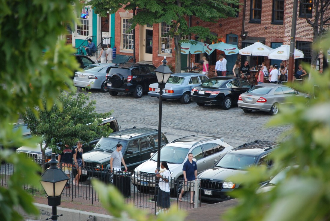
Welcome to Fells Point in 2007, where conversation and moderation are taking over from loud music and drunkenness, the bulk of the bar patrons seem to have graduated from college or grad school, and home prices are well on the way to $1 million and the typical monthly rent has long since breached $1,000.

It wasn’t always like this, of course. Forty years ago, Fells Point was a target for demolition, a waterfront slum of centuries-old buildings about to be sacrificed for a highway. Thirty years ago, with the neighborhood barely spared the wrecking ball, bohemians, bikers, and the John Waters crowd had settled in to wallow in the post-industrial grit of the seaport, cheek to jowl with sailors, immigrants’ sons, and the not-quite-working class that had long called it home. Twenty years ago, college kids and professionals had joined in the fun, their sharp elbows and fat wallets often giving old-timers a rash, while a rising tide of tourists gawked. A decade ago, the moneyed crowds had made even greater inroads, some of them moving into reasonably priced homes or fire-sale fixer-uppers, attracted to the same everyone’s-welcome feel of a waterfront place that kept bringing in the out-of-towners.

Today, Fells Point is largely given over to money and sophistication, and lots of it. Only hints of its grizzled old soul peek from beneath the prosperity. Taverns that used to draw a local crowd of limited means have changed hands for outrageously high sums, and they face catering to a more well-to-do crowd or making way for new owners who will. Civility is the rule, juvenile drunken hijinks the exception. As one local who grew up in Fells Point, Ted Lubonovich, put it recently, “Gone are the days when sailors would drink with a judge on Saturday, and then appear before him in court on Monday for whatever they’d done after the judge left.” For some of the old bars and taverns, the newcomers are inscrutable, but at least they bring in the cash.

Not everyone’s happy about this, and not everyone has adjusted to the new reality, including this writer, who, after a quarter century of Fells Point meanderings, including a stint as a bartender, freely admits to a fondness for the bohemian leanings of earlier times. Fells Point remains a welcoming place where the it-takes-all-kinds mentality that city living demands remains deeply rooted in the neighborhood values, but with money often comes an investors’ attitude. Having mortgaged to the max on a $750,000 rowhouse, or having signed a $2,500-a-month lease, many newcomers’ interests in their own properties take precedence over broader communitywide concerns, such as how to protect and promote the Point’s small businesses.

The wave of prosperity also has overtaken the longtime hosts of the Fells Point scene: its bars and taverns. If you’ve owned a bar for 30 years and you’re tired, it’s tempting to sell out for $1.5 million and let the next guy see what he can make of it–which damn well won’t be a dusty old corner bar for the shallow pockets of old. The changes are palpable, and, by the look of it, more are on the way.

DSC_3754

Larry Silverstein spent much of January and February tending to a development project he’s undertaken in Costa Rica, but on a recent Saturday morning he’s back in his office where he got his start in the development business: Fells Point. The 41-year-old native of the Baltimore suburbs settled in the Point in 1996, flush from making buckets of money off technology stocks during his post-college years in New York. Even 10 years ago, as he acclimated to his new home, he noted the changes in the neighborhood from when he used to carouse in its bars in the mid-1980s. And he smelled a rich opportunity.

“Growing up, when we went out in high school, Fells Point was a much different place,” he says, recalling his reintroduction to the neighborhood. “It had gone from biker bars to a post-high school and college hangout–places like the Greene Turtle and that bar in Brown’s Wharf, [the now-defunct] Surfside Sally’s. So I started coming down, spending time here, and thought that an area like this–no flow-through traffic, with cobblestone streets, on the water, with all the old buildings–could only go up. I started looking for something to do down here, and I found this building.”

It was the old Union Box Co. building at the corner of Wolfe and Lancaster streets, and Silverstein picked it up for $350,000 in 1997, turned it into 50,000 square feet of office space, and soon was on his way to creating substantial personal wealth out of old Fells Point spaces. He also has completed redeveloping 900 S. Wolfe St., which houses his restaurant Red Star, and 906 S. Wolfe, which houses office space, and acquired the old Arundel Concrete plant across the street from it. His other Fells Point projects include two housing developments, one on Lancaster Street and the other on Aliceanna Street. And in 2005, he bought the Waterfront Hotel building for $1 million.

Ironically, Silverstein believes the “dead end” quality of Fells Point makes it especially suitable for prosperity.

“It’s an enclave,” Silverstein explains. “It’s a place that people have to go to, as opposed to pass through. It has a serious geographical barrier, with the water, and it actually is a little bit of a peninsula. From Aliceanna Street south, you’re not going to drive through there, it’s not a shortcut to anywhere, so you get these quiet residential streets that are narrow. You get density on the street, which is lacking in other places in the city. Fells Point has maintained its old historic fabric, so I think it’s a place people like to congregate. It’s Baltimore’s original mixed-use neighborhood. It’s stayed that way for 300 years now.”

Part of that mixed-use tradition is the bar scene, going back for as long as people have been thirsty. But Silverstein notes that the standby bars are changing hands with the advent of a more prosperous Fells Point.

“What you’re seeing is kind of a passing of the old guard,” he observes. “You have a lot of people in the same age bracket that have been in a tough business and done reasonably well for a while now down here, and they see the real estate values have gone up, and it’s a good time to cash out. And I imagine that for a lot of these people, that’s their retirement.”

Howard Gerber, for instance, had owned the Horse You Came in On on Thames Street since the early 1970s; he auctioned it off last November for $1.58 million. In 2005, the Glyphis family sold the River Drive Inn on Thames Street (better known as Miss Irene’s) after decades of ownership for $1.15 million. And Read and Louise Hopkins, who had owned the Whistling Oyster at the foot of Broadway since 1973, fetched $650,000 for their place in 2005, according to real estate records.

Silverstein starts rattling off other Fells Point bars that may be in the same boat–the Dead End, the Wharf Rat, Bertha’s, and others. According to Paul Haslup, a real estate agent who helps broker Fells Point bar deals, each of those three bars is currently listed: the Dead End for $1.8 million, the Wharf Rat for $1.1 million, and Bertha’s for $2.9 million. “Virtually every bar has changed hands or looks like it will change hands in Fells Point,” Silverstein says, though he adds, “I’ve never heard anything about the Cat’s Eye.

“Some of their businesses are based on a model that no longer is working in Fells Point,” Silverstein continues. “The dollar beers, the shots–that’s no longer the crowd down here. You get some of it, but the neighborhood is pushing toward more tavern, more restaurant, than bar.”

It’s not that Silverstein thinks the old-guard bars of Fells Point are vestigial artifacts that have no place in the new prosperity; they just have to figure out how to strengthen their standing in the face of all the new money. “They have an appeal, even to the people who are moving down here,” he says. “They just have to kind of get it together with a little bit with marketing, or maybe eventually people just will rediscover them.

“In my mind, that was the appeal of Fells Point,” Silverstein continues. “A place like the Wharf Rat, that’s off the main path–I think that’s a great bar nestled in the neighborhood. Unfortunately, with who lives here now, you will never be able to do a place like that again. What’s here is here, and once [the old bars] close, it will get in-filled with residential or something different. But there’s not much left down here–the Cat’s Eye being the exception–where you have that regular crowd.”

IMG_8089

“It’s getting kind of dull around here,” Glenn Moomau observes between bites of food and sips of red wine at a table in the tented backyard garden of John Stevens Ltd. Moomau, an American University literature professor who for the last 16 years has played harmonica on Sundays at the Cat’s Eye with Steve Kraemer and the Bluesicians, is a little blasé about the current state of Fells Point, where he owns a building with four apartments and three stores. But he says he still loves it for the little bit of soul that remains. Moomau, 47, arrived here in 1990 from Washington, a little late for the true grit of the old days, but early enough to get a taste of it.

“At the Cat’s Eye, you’d get a guy who worked at the General Motors plant standing next to a heart surgeon from Hopkins,” Moomau recalls. “That was the beauty of Fells Point, all these people mixed in harmony at the bars.”

He talks of the neighborhood characters who are still around–Jaguar, who takes photographs for tourists and barhoppers; Digger Andy, who burrows for treasures beneath long-abandoned backyard outhouses; Bankrobber Jerry, an old vet who wears a helmet to protect what’s left of his injured head. He also lists those who are missing in action–the transvestite hookers, the guy who tap-danced at the bars, characters with nicknames like Muldoon, the old ethnic joints that closed down years ago.

When Moomau took up residence in Fells Point in 1990, “it was already being gentrified,” he explains, “and the old-timers were already complaining that it was kaput.” But the changes had only just begun. Some are reflected in the U.S. Census Bureau figures for Fells Point. In 1990, nearly a quarter of the Point’s residents were living in poverty, and nearly half the households were making $20,000 or less annually. In 2000, less than a 10th of the population was poverty-stricken, and less than a fifth brought in $20,000 or less. The median rent in 1990 was $455–meaning half of the residents were paying less than that. By 2000 the median-rent figure was somewhere in the neighborhood of $700. One can only imagine, given the prosperity that’s taken hold in the seven years since, what today’s figures are.

While the Point is more prosperous these days, Moomau says that the proliferation of money-based self-interest has hurt the neighborhood’s feel. “The problem with this neighborhood now, with the exception of a few people, is that most people in this neighborhood only vote their pocketbook,” he explains. “They’re only concerned about their block or their corner. And that angers me. And the people who own these antique houses around here, they’re very anti-business–especially small business–and I think that’s a problem. That’s what the neighborhood’s built on, the small businesses, so it’s not really a cohesive neighborhood.

“Back when none of this property was really worthy anything, people were much more relaxed. You had a different kind of person–it wasn’t a person who was buying something for an investment. Now, you have people who are like, `I don’t want somebody opening a coffee shop right next door to my house.’ But that’s the thing that made this neighborhood kind of cool, was that there was kind of frontier element–you know, you could do what you wanted with your property.”

IMG_8088

What Moomau is driving at when he talks about restrictions on how people can use their property in Fells Point is an issue currently before the Baltimore City Council. On Feb. 28, the council’s Land Use and Transportation Committee held a hearing on City Council Bill 06-0464–Rezoning–Properties in Historic Southeast Baltimore. As City Councilman James Kraft (D-1st District) explained at the hearing, the bill is the culmination of a process that began in 2005 as an attempt to clear up confusion over property-use rules that had built up over several decades of piecemeal zoning measures. The point, Kraft said at the hearing, is to simplify matters “so that when a person purchases or sells their property, they would know what the zoning is, and they don’t have to deal with the multiple layers on top of it.”

As one might expect, Fells Point’s rezoning prospects are the source of deep controversy. The proposed zoning map has especially rankled people concerned about the fate of small-business uses of property. Larry Silverstein is not alone when he notes that the map reflects “the influence of the wealthier, more organized people who live here now, who want this to be more of a homeowners’ neighborhood, and less of a business neighborhood.”

The map proposes that Broadway and Thames have the highest-density, most-uses-allowed business zoning, and that fewer businesses will be allowed on the streets off those two main drags, including switching to residential zoning in several areas where businesses are now allowed. Current businesses are grandfathered in, but when they stop operating, if no commercial use replaces them within a year, the grandfather clause lapses, and only uses within the designated zoning would be allowed from that point on.

Silverstein says he’s finished all the development he planned to do in Fells Point, so the issue will not affect his bottom-line interests. But, he points out, “with the current rezoning, every single project I’ve done in Fells Point would not have been allowed. And I think that’s a mistake.”

Lily Adlin, who with her husband, Nelson Adlin, owns several properties with commercial tenants in Fells Point, is wary about the zoning changes proposed for Fleet Street, east of Broadway–changes that are also proposed for similar stretches of longstanding Fells Point commercial corridors.

“They are planning to dam up Fleet Street by creating two locks,” Adlin explains, using a canal metaphor. The two blocks of Fleet from Broadway to Ann Street, she explains, will keep its B-2 zoning, which allows a relatively wide variety of commercial uses, including such businesses as check-cashing agencies and restaurants and taverns without live entertainment. But then, from Ann Street to Washington Street–the next four blocks heading east on Fleet–“they’re going to put a lock on it by reducing it to B-1, which is terribly restrictive, and then east of Washington, it is going to be R-8, and you can’t have business at all in R-8.” The B-1 designation does not allow taverns, bars, or check-cashing operations, among other uses.

“We want all of Fleet Street to be B-2,” Adlin continues, “because it needs more business to bring in more people, which is what the merchants on Fleet Street desperately need.” She worries that if B-2 zoning (which allows 134 types of business uses) is switched to B-1 (which allows only 39 types of business uses), the businesses that remain will lose their critical mass and stop drawing customers from beyond the area. “They can’t depend on the neighbors to keep their businesses afloat,” she says.

Adlin reiterates Silverstein’s point about Fells Point residents having disproportionate sway over the task force that has guided the rezoning process. “The task force was made up primarily of residential groups,” she explains. “There were only two business groups on it, and about 16 residential groups. So the businesses were not well-represented, and the residents there don’t want businesses encroaching on their comfort.”

Indeed, at the two-hour Feb. 28 Land Use and Transportation Committee hearing, Adlin and a few others testified about their concerns over ratcheting down business zoning in Fells Point, while residents’ representatives gave blanket support for the proposed zoning. (Hispanic groups forcefully voiced concerns similar to Adlin’s about the area of South Broadway north of Fells Point, where less intensive business zoning also was being proposed.)

Silverstein surmises that merchants failed to participate as much as the residents because, even though everyone was invited to join in what he calls “an open process” that resulted in the proposed zoning map, “business owners are busy, and they don’t have time to go to these meetings. And they don’t really think anything’s going to affect them until it actually hits them in the face. But if you buy a house for a million dollars, you don’t want to live next door to a bar with live music. So you’re getting friction between the new homeowners and the existing businesses.”

The result over time, Adlin and Silverstein argue, will be fewer businesses in large areas of Fells Point. “Unfortunately, if this goes through, you’re not going to get any new businesses on some of these blocks that are one or two back from the main streets,” Silverstein says. “And that really has always been part of Fells Point–you walk through these alleys and back streets and stumble onto a store that you didn’t know was there. That’s going to get much harder.”

Kraft was out of town and unavailable for comment for this story before press time.

The points that Adlin and Silverstein make about the Fells Point rezoning are not challenged by Arthur Perschetz, president of the Fells Point Homeowners Association. Except, he points out, there’s a “tension that exists” within the homeowners’ group “between those who are looking for Ruxton on the Patapsco and others who like the mixed-use environment as it is. Some people really like the synergy, the vibe, the rough cutting edge of Fells Point the way it’s been, but some who have moved in over the last few years, when prices for property have gone up so significantly, didn’t necessarily want a store right next door to them.”

Perschetz acknowledges that, yes, the effect of the proposed zoning map is that portions of Fells Point where shops and bars have long been operating will have fewer businesses there as the years go by. But, he adds, the small-business operators still have a chance to have their voices heard.

“The business owners had an opportunity to go to the hearings [over the last two years], as did everyone,” Perschetz says. “But they’re not shut out yet.” The City Council rezoning bill still has to make its way through the legislative process, he says, so “they still have an opportunity to come and make their case.”

DSC_0209

For 23 years, from 1976 to 1999, Fells Point was home to a charismatic character who marshaled the neighborhood forces when such controversies as the current rezoning battle occurred: Steve Bunker, owner of the China Sea Marine Trading Co., which traded in maritime curiosities. Bunker is still an absentee presence in Fells Point, often visiting, more often spending quality phone time with the locals from his home in Maine. But he’s no longer present for the fights, except as a long-distance adviser.

“I wish it were still a little rougher around the edges,” Bunker says of Fells Point, after having paid a recent visit. His eye-catching countenance–a thick mustache, long locks hanging from under a Greek fisherman’s cap, and a parrot on his shoulder–is easily imagined, though he’s speaking by phone.

“On the one hand, the cute-sification of the place–a lot of it is just a facade, because, on the other hand, two or three blocks back from the water, a lot of it is still there, with the immigrants and the Gypsies, if you can find them,” he expounds. “But the city is getting greedy, and they’re running off the stable part of the neighborhood. In the long run, the city is not going to prosper when the new people come in, buy expensive homes, live there for a couple of years, and then run off to the suburbs to live out the rest of their lives.”

In Bunker’s day, Fells Point was a long-term haven for people seeking new beginnings after a bitter turn. “It was the kind of neighborhood where you could come in from somewhere else and, with very little money, make a new start,” he explains. “I loved that.” At the same time, the neighborhood drew some powerful people, he recalls–sometimes under the cover of night, for covert vice sessions with the salty crowd that hung out after hours in the back room of the Cat’s Eye Pub. “The back room at the Cat’s Eye was kind of a local institution,” Bunker says. “Politicians of some note have showed up there at 3 or 4 in the morning. The local cops all knew about it, and people behaved themselves.”

These nocturnal connections proved valuable during the various fights over Fells Point’s future. “We had people slipping us information in the middle of the night, and professionals with skills and knowledge and connections helped us,” Bunker continues. Those connections helped during what he calls “the end of the road fight,” which stopped the proposed highway from coming through Fells Point in the late 1970s, and helped Bunker and other Fells Pointers resist unchecked development as the neighborhood’s star rose.

“What we wanted to do was maintain the neighborhood as conservatively as possible for as long as we could, maintain its livable scale,” he says. “So we fought the condoization of Fells Point, and a lot of the developers who came through were empty jackets who would’ve left us with a bunch of white-elephant rental towers–we beat ’em, every one of them.”

The experiences strengthened Fells Point’s resolve as a community, Bunker recalls. “And that continuity and institutional memory was terribly important, as was the spirit that everybody keeps in mind the interests of their neighbors, and the understanding that small business was the engine of it all,” he says. “We developed a lot of skill, and you could deal with us–once a bad plan was beaten back, we would sit down and talk it out. But there was that break in the late 1990s, the early 2000s, when everyone kind of was lulled as a real pressure was being exerted to bring in intensive development. We knew that Fells Point was going to change–that’s why I left when I did.”

Other old-timers disappeared over time, as well. “Most of them have pretty much died, and a lot of others have been forced out of the neighborhood by high rents or, if they were owners, by higher taxes–or they were forced out just by the feel of it,” Bunker says. “The newcomers kind of bleached out the neighborhood.” And even though “there is probably more [political] skill in the neighborhood now than when we were there,” he adds, residents and business owners are having trouble keeping up the resistance.

“A lot of them are like deer caught in a headlight in the face of all that’s coming so quickly,” he says. “Some of the professionals there now don’t have time to deal with the neighborhood, or they see it as an investment, not a home. We were able to keep development down to a dull roar, but today, I don’t know what you can do about it.”

DSC_3821 (1)

“They’re doing somebody’s bidding and I don’t know whose, and I don’t understand it,” fumes Alicia Horn from across the bar at Birds of Feather, which she’s run on Aliceanna Street since the `80s. She’s talking about the city government and its current rezoning proposal, which, along with another proposal to designate Fells Point a historic district and a “renewal area,” would supercede the Fells Point Urban Renewal Plan–one of the longstanding land-use overlays that, city planners say, confuse the zoning. “Don’t fix something when it ain’t broke, and they’re getting rid of it,” Horn says. “You have a problem with that plan, then tweak it. Because we’ve had that plan since the ’70s, and it’s worked.”

The Fells Point Urban Renewal Plan has guided development in the area for more than 30 years, with numerous controversies over the years regarding modifications to it. Horn fears that the end of it would lead to ever greater heights and densities in the neighborhood.

“When density and height restrictions go away, the properties that are available down near the water are going to get big,” she says. “And then it’s all going to get to be like Inner Harbor East, where Spinnaker Bay and all that is.

“It’s good for business, for people like me–it really is,” she continues. “I get a lot of neighborhood people in here now, and that will only get better. And, as this happens, my property’s going to be worth more money for me to retire on. But I’m against the city trying to restrict certain people through zoning and historic guidelines, and helping others to build big buildings. It seems to me that they’re working with developers rather than working with the community.”

So what’s wrong with big buildings surrounding the small-scale historic structures of Fells Point? “Well, it’ll be sort of like Little Italy, where those big tall buildings shadow the areas right adjacent to it,” Horn says. “The wind will start funneling through, and it’ll be gross. And the traffic will get worse and worse and worse. And historic view corridors straight to the water will be blocked. The area won’t be livable like it is now.

“Things change, yes, and everything changes. Yes, it’s making it nicer for people to live here when you have condos and high-end apartments. But then you have to ask, how are all those people going to get into and out of this neighborhood every day, and where are people going to park?”

“So in other words, we should put a horse farm down there?” asks Brown Benson, Horn’s friend and patron and a master of sarcasm. He’s eating a Quiznos sandwich and sipping a glass of wine and, after more wine, he’s primed to play a strident devil’s advocate. “Then, what? The only places we can put the tall buildings is in Columbia, Hunt Valley? Where we going to put the tall buildings, in Mount Vernon? Charles Village?

“I live in Inner Harbor East, and you know what? I think they should have built it taller,” Benson continues. “I mean, I get the argument that the water view can get blocked, but look at it–we’re not looking at the Mediterranean here! Yes, there can be some city planning, but urban areas evolve. And they should be allowed to evolve. If people want high buildings, well, fine. I just don’t get it.”

For 10 years, Patrick Hill has owned the Unicorn Studio, a frame shop and art gallery on the 600 block of South Broadway that sits next to a proposed redevelopment centered on the north end of the Broadway Market. It’s called the Marketplace at Fells Point. As proposed by the developers–Dave Holmes and Dan Winner–the $50 million project would involve a nine-story complex consisting of a five-story parking garage and four stories of new residences. To say Hill is thrilled to the core about the proposal would be an understatement; he can barely contain himself when asked about the plan.

“What these guys wanted to do initially just seemed to be too good to be true,” Hill recalls of his first encounter with the idea about a year ago. “I mean, [Winner and Holmes are] just going to come in and sink all this money into trying to build things up without trying to seize properties and not get the city government involved really. I mean, come on, it’s too good to be true. But it looks like it’s a go. And the city is way behind the project, is what I understand.

“This is the point that I want to make,” Hill sums up. “This block here, the 600 block of South Broadway, has been falling apart for years, and everybody’s been turning a blind eye to it. Everything that gets done in Fells Point stayed down there on the square at the foot of Broadway, Thames Street, and on the 700 block, and this block was totally neglected. It was the red-headed stepchild of Fells Point. So what do you think’s going to happen? Well, it’s either going to be torn down or redeveloped. We’re down to five businesses on this block, and the Broadway Market has virtually nothing to offer. Now somebody wants to do something about it, and it’s going to be a gateway north to the rest of Fells Point. Finally, people might start wanting to come up here. This is long overdue. It should have happened years ago.”

Many Fells Pointers agree, though not everyone, and the sticking point is over the proposal’s height–the same issue over which Horn and Benson disagree for Fells Point as a whole.

“Dan Winner and Dave Holmes are good guys, and their hearts are in the right place,” Bunker says, diplomatically. “And I view the revitalization of the north end of Broadway Market as wonderful, but you’re a little naive if you fail to worry about what the height is going to mean in the long run. Height and density are the big bugaboos down there, and if a 10-story project goes in, then a 20-story one eventually will go in right behind it. And you can end up creating a canyon down there pretty easily. Again, the scale of living is what has kept Fells Point unique, and very livable, and that’s what’s wrong with this project–it’s out of scale.”

Holmes and Winner have overcome a lot of initial hesitation about their plan, including from Kraft, regarding its scale. “We respect that,” Holmes says of Bunker’s concern about the scale of the project. “But we won the hearts and minds of a lot of folks.” The need to include the parking garage was what added height to the proposal, he explains, and “without that parking this project could not be what it needs to be.

“This isn’t about trying to build some high-rise,” Holmes says. “As for what comes in the future, 50 years from now hopefully people will see the benefit the community gets from this project. It might raise the question of just how important is height to the future of Fells Point.”

IMG_0977

Another one of the “big bugaboos” in Fells Point for years was a woman from Ruxton, in Baltimore County, named Lucretia Fisher. Now in her 90s and still living in her Ruxton home, Fisher came down to Fells Point as an investor in the 1960s and started to buy up bundles of overlooked old buildings. When she found out about the plans for building a highway through the area, she became one of the most important players in stopping it. Still, despite her role in saving the Point, she earned the ire of the bar owners and residents who came in after her, including Bunker–though he gives her credit where credit is due.

“Lu Fisher was a speculator in her own right,” he explains. “She grabbed her property, got it cheap, rented it out as slum property for years, and then sold it out. I had many friends who lived in her run-down places. And when [former Cat’s Eye owner] Kenny Orye died in 1987, everybody expected Lu Fisher to grab for it. The day after his funeral, she came into the Cat’s Eye with a couple of the biddies from Ruxton and started talking, `Let’s put a tea room here.’ It was a vulgar thing to do. But she was there at a time when she was needed, when a lot of folks were needed to do what had to be done, which was to buy a lot of property so they could stop the road.” (Anthony Cushing ultimately purchased the Cat’s Eye; if he’s plans to sell it, he’s keeping mighty quiet about it.)

These days, Fisher is almost entirely divested of Fells Point properties, but she’s happy to talk about what was once her “favorite place in the world.” While she’s a little vague on the dates and proper names of places and people, she’s still on the ball when it comes to her opinions about the Point. She acknowledges that she never liked the Cat’s Eye and its ilk. “They were mostly drunks, people who were more concerned about getting drinks in those building than they were about the buildings themselves–or Fells Point, for that matter,” she says. Instead, Fisher says she was busily “trying to get people to care about the area, which I thought had a big future.” Now that the future’s here, with all the money and new residents and offices and parking garages, and more on the way, she’s thoroughly disappointed.

“I think the whole area is going to be ruined,” Fisher asserts with helpless frustration. “I feel that I’m not going to see it when it happens, because I’m so old. But it’s already starting with all this wealth coming down there, and these big buildings covering up the waterfront. It’s going to be overdone, and by the time they’re finished, you won’t see any water. You will have lost the original attraction completely. And they say they will put protections in place [to prevent overbuilding], but I have no belief in protections when they can be changed so quickly.”

Fisher is especially disappointed by the current state of the the City Recreational Pier. The mammoth historic building, jutting out into the harbor just east of the Broadway Pier, has been largely derelict for many years now. In 2004, the city put out a call for redevelopment proposals, attracting a host of interested parties from around the country with substantial financial backing. In the end, it was awarded to J. Joseph Clarke, the husband of Baltimore City Councilwoman Mary Pat Clarke (D-14th District), but after a series of setbacks he has yet to start the project. This frustrates Fisher no end.

“Why did they think that Joe Clarke was so good for it?” she wonders with a mystified laugh. “I was so surprised that it ended up with him, because it is a perfectly huge thing, and it’s got to be done right. But now, it’s nothing again.”

While the Rec Pier redevelopment has been delayed, Fisher’s engaging in a bit of hyperbole to state that “it’s nothing again.” Clarke, reached by phone on March 15, says several key hurdles are almost cleared, and he expects to begin work on the $50 million, 130-room hotel project this summer, “assuming all the pieces fit together.” He estimates that, once started, it will take two years to build, though adds that “it may be more.”

The Rec Pier aside, Fisher’s pessimistic view that Fells Point is falling victim to its own prosperity suggests that her strategy–to disinvest–may be wise. The old-guard bar and restaurant owners have started to follow suit, taking advantage of a flush market by cashing out. So has Silverstein. Because eventually, as Glenn Moomau likes to point out, the big wave will come, one that Fells Point investors may have a hard time riding.

“In 50 years it’s all going to be underwater, you know,” he says with a knowing grin. Sea-level rise, after all, is no joke, and the Chesapeake Bay is rising even faster due to land subsidence, making Fells Point flooding on the order of 2004’s Hurricane Isabel, when kayakers were able to paddle blocks back from Thames Street, an ever more likely occurrence. “I plan on selling here in a few years,” Moomau says, “before the deluge comes.”

Aquageddon: A disappearing island shows what rising sea levels mean for the Chesapeake Bay

By Van Smith

Published in City Paper, Apr. 17, 2013

DSC_4628

My trusty handheld GPS helps keep me safe while kayaking, letting me know precisely where I am on a map. But bringing it along on kayaking trips, it turns out, can serve more than my own personal safety: It’s also a useful tool to map the land-devouring effects of sea-level rise in the Chesapeake Bay.

On April 21, 2007, I kayaked around James Island (pictured), at the mouth of the Little Choptank River, in Dorchester County on Maryland’s Eastern Shore. The outing, for which I made camp at the nearby Taylor’s Island Family Campground, was part of my research for an article about exploring the Chesapeake Bay’s vanishing islands (“Wetlands,” Feature, May 23, 2007), about 40 of which oceanographer William Cronin had chronicled in his 2005 book, The Disappearing Islands of the Chesapeake.

As Cronin pointed out, sea-level rise in the bay had been estimated at 3 feet per millennium until about 1900, but then, over the course of the 20th century, a 1-foot rise was observed-an acceleration that washed away at least three notable islands and was eating away at the rest.

As I circumnavigated James Island in 2007, hugging the shoreline as closely as possible while dodging fallen pine trees partially submerged in the murky water, my GPS recorded my route, laying it out like a bread-crumb trail on its map. In the end, I’d mapped the contours of the island’s shore-or, rather, the coastline of its three islets, since James is no longer a single island.

The shoreline here is virtually free of gradually sloping beaches and instead ends abruptly with short, precipitous drops into the drink. The small cliffs have been left behind after chunks of land fall into the bay as it erodes, similar to the way melting glaciers lose pieces of their mass in a process known as “ice calving.” Thus, the bay’s tides, rather than going in and out along the shoreline, covering up and then exposing the intertidal zone, go up and down vertically along the bold shore, allowing a shallow-draft craft like a kayak to stay quite close to land regardless of when in the tide cycle one is paddling.

James Island used to be populated as recently as the early 1900s, with 20 houses, a school, a boatyard, a church, and a cemetery. Studies have described its inexorable and ongoing destruction: from 975 acres in 1848 to 72 acres in 2006, losing an average of 5.7 acres annually over the course of those 158 years. A return trip with my GPS would allow me to estimate its land loss in the past six years and calculate whether its rate of loss was more or less than the historical record indicated.

Also in 2007, I gunk-holed around the nearby coast of Taylor’s Island, lingering close to a farmhouse at the northern mouth of Oyster Cove that was precariously close to falling into the bay, and noting the ochre cliffs, 6-plus feet high, that had formed as farmland had been shorn off in great chunks by the force of incoming waves. A return trip with the GPS could provide me with a rough indication of how much more farmland had been lost to the bay’s rising waters-though the fate of the house would be a matter of simply using my eyes.

First I paddled from the campground on Taylor’s Island to the Oyster Cove farmhouse, which is now reduced to a pile of rubble. My GPS indicates I paddled on water about 100 feet inland from where I’d been in 2007-a feat only possible due to a significant sacrifice of farmland to Neptune. When I had asked about this earlier at the campground, an old-timer estimated about 30 acres of this farm had fallen into the bay in the last five years or so-as reasonable a guess as any, I suppose, given that the bay’s now 100 feet further inland.

I headed out from the Oyster Cove point to the southern tip of James Island-a stretch that has lengthened in the past six years, according to my GPS. It’s now a 0.6 mile trip, about 530 feet more than it was in 2007, yet another measurement of vanished land. Then I paddled around the three islets, forming another GPS bread-crumb trail that, when compared to the one laid down in 2007, indicates 67 percent of James Island’s land has succumbed to the Chesapeake’s tides in six years. The rate-6.2 acres per year-is a half-acre more than the average annual rate of land loss over the 158 years prior to 2006.

CP’s webmaster Andrew Vogel took the GPS locational data from my two trips around James Island, imported it into Google Earth, and used the software to create two shapes for each island, one for 2007 and the other for this year. Google Earth then automatically calculated the area for each of the shapes, providing precise measurements to determine how much land James Island lost in the intervening six years.

The results are striking: 37.3 acres have been lost, leaving behind a paltry 18.3. The middle island suffered most, losing at least 16 of the 21 acres it had in 2007.

Based on the GPS coordinates recorded during my two paddling trips, two broad conclusions about the James Island coastline are clear: The bay’s rising waters are claiming its land, and they are claiming it faster than in the past.

Turns out, that’s not surprising. Last year, two groups of scientists published research indicating not only that the mid-Atlantic coast’s sea level recently rose significantly faster than the global average, but that its rate of rise in the Chesapeake Bay is accelerating.

James Island is “like a canary in a coal mine,” says Court Stevenson, a professor at University of Maryland’s Center for Environmental Science in Cambridge and a long-respected expert on sea-level rise’s impacts on the bay’s shores. He recalls going to James Island about 15 years ago and tagging 100 pine trees whose circumference he intended to measure to determine their rate of growth. “We went back a year a half, two years later, not a tree was standing. They were all gone-100 of them. Basically, our whole study was gone.

That kind of rapid land loss, especially if it quickens with an acceleration of sea-level rise, may well foretell the story of the Chesapeake Bay coastline’s future.In 1914, J. Fred. Hunter of the U.S. Geological Survey (USGS) studied several of the Chesapeake’s fast-eroding islands near the Choptank and Little Choptank rivers, including James Island. After chronicling the land-loss facts based on available evidence, Hunter hazarded a guess: James Island “should disappear in about 150 years,” while adding the blanket caveat that “numerous other factors may enter to disturb the present conditions and rate of erosion.”

Interestingly, should James Island’s land-loss rate of the past six years continue apace, Hunter’s prediction that it will have vanished by 2064 would prove quite prescient. If it continues to lose about 67 percent of its acreage every six years, by 2064 only a third of an acre would remain.

Since I can’t paddle over land, and wasn’t willing to trespass on the Oyster Creek farmland to walk the edge of its cliffs with my GPS, it’s anybody’s guess how much of its acreage has been lost-and how much more will calve off into the bay in the future. But more will; as James Island’s destruction continues, the shore it protected from the waves will take ever-worse beatings and more direct hits by wind-driven waves.

Meanwhile, Hunter’s caveat in making his prediction about James Island’s disappearance-the “other factors”-recently entered into play. The fact that the Chesapeake region’s land continues to subside, thanks to a combination of long-term regional settling of the Earth’s crust after the glaciers last melted, starting about 18,000 years ago, and the more recent drawing down of groundwater as population swelled, only compounds the sea’s accelerating encroachment on land. And that encroachment, based on recent science, is becoming more and more worrisome.

In a paper appearing last June in Nature Climate Change, USGS researchers identified a 1,000-mile long “hotspot” on the East Coast between Cape Hatteras in North Carolina and just north of Cape Cod in Massachusetts – which includes the bay – where sea-level rise has accelerated at three to four times the global average over the last 20 years. This discovery was followed in October by a Geophysical Research Letters paper by a two-man, British-American team of oceanographers who found that the bay’s sea-level rise may have sped up from 1 to 3 millimeters per year in the 1930s to 4 to 10 millimeters per year so far in the 2000s. If the 10-millimeter high end holds true in the future, then the bay’s water will rise a little bit more in the next 100 years than it did in the 1,000 years prior to 1900.

In short, scientists recently started to detect a “hockey stick” shape to the sea-level-rise curve for the Chesapeake Bay, which would spell faster-arriving impacts from the already-expected inundation resulting from climate change. No wonder, then, that James Island’s land loss has been appreciably faster in the last six years than in the preceding period back to 1848. It’s just one example of a near-endless litany of anxiety-inducing repercussions that faster-rising seas are expected to have on the bay.

Stevenson, who says he first came to live on and study the bay in 1972, says that “when I first started talking about sea-level rise, people thought it was just sort of flat-it was increasing but it wasn’t accelerating. But now it is inflecting upwards, and that spells trouble. You just get much more erosion since the water level is higher and higher in the flood plain, and the wave attack is much, much higher, and places that once were underwater only a few hours a day get inundated much more of the day, so they just keep getting this wave action that just keeps beating on it. If sea level is inflecting upwards, then it’s all just going to happen a lot quicker than we had seen in previous centuries of sea-level rise. And that, in a nutshell, is what a number of us who are concerned about sea-level rise are worried about.”

Not surprisingly, such worries have been getting high-level attention.

On Dec. 28, Gov. Martin O’Malley (D) signed an executive order that, had it been read at the time by Marylanders trying to enjoy a holiday break from their routines, would likely have caused some to choke on their eggnog.

It’s purpose was dry enough-that state agencies incorporate the risk of inundation from coastal flooding and sea-level rise into all planning for future state-capital projects, that agency construction projects be built at least 2 feet above the 100-year flood line, and that additional recommendations for safely building or renovating state structures in light of sea-level rise be devised quickly. But its preamble-the “Whereas” section-cited the recent USGS “hotspot” study to tick off a list of current and anticipated problems sea-level rise entails. Among them were:

-“The State of Maryland is currently losing approximately 580 acres every year to shore erosion.”

-“Alarmingly, thirteen Chesapeake Bay islands once mapped on nautical charts have been lost.”

-“Future changes in sea level threaten to increase the State of Maryland’s vulnerability to storm events, causing more shore erosion and severe coastal flooding, inundating low-lying lands, submerging tidal wetlands and marshes, and resulting in additional salt-water intrusion, and high water tables.”

-“The State of Maryland has approximately 450 existing State-owned facilities and 400 miles of roadways within areas likely to be impacted by sea level rise over the next 100 years.”

-“Billions of dollars of investments in public infrastructure will be threatened if the State of Maryland fails to prepare adequately for climate change.”

In the neighboring state of Delaware, Gov. Jack Markell (D) got into the act in January, with a “state of the state” address that envisioned a future so threatened by rising seas-and especially the hurricanes that come with them-that the time has arrived to do triage on what can and cannot be protected. Calling last fall’s Superstorm Sandy a “wakeup call,” Markell said that Delaware must start “strengthening dikes and dams, conserving wetlands, improving drainage, or nourishing beaches,” but “the need for this infrastructure exceeds the resources available,” so the state must have a “frank conversation” about how to “prioritize and finance projects, so that we protect what we can and make realistic choices about what we cannot.”

There have long been such frank conversations about restoring the bay’s vanishing islands with dredging spoils, 3 to 4 million cubic yards of which are scooped out of the bay’s channels each year to keep the Port of Baltimore accessible to ships. Since 2006, James Island has been one of the islands selected to be built back up this way, as part of something called the Mid-Chesapeake Bay Island Ecosystem Restoration Program, which would provide new uplands and wetlands as wildlife habitat and also recreate a buffer to help protect the Little Choptank River coastline from ongoing loss of land. But other than studies-many of them have been conducted, providing a wealth of details about James Island’s history, ecology, and geology-there’s been no further action.

The project is “unfortunately stalled,” says Maryland state Del. Jeannie Haddaway-Riccio (R-District 37B), who represents several bay-facing Eastern Shore counties and strongly supports the program. The reason, she says, is that it relies on “federal money that has not been dedicated other than to planning.” Still, she stresses the need to “shore up those islands” to provide a buffer for communities and landowners to the east.

“The longer we put it off,” she says, “the more expensive and harder it is to rectify.” She says that on Hooper’s Island, just south of Taylor’s Island, “gravesites have been going into the water” and notes that “it’s amazing, the cliffs that have been created” by the gouging action of the waves hitting the shore.

At Taylor’s Island Family Campground, owner Bruce Coulson has a front-row seat to the damage wrought by sea-level rise. He and his group, the Dorchester County Shoreline Erosion Group, have long promoted ways to reduce the force of the waves pounding the shoreline in these parts so the bay’s increasingly ravenous appetite for nearby land will be slowed. He has good reason: The bay’s been stealing away his land-though not as fast as it’s been taking it from other nearby landowners, thanks to the huge chunks of concrete he’s placed along his shoreline. Each weighs 15,000 to 20,000 pounds, he estimates, yet the waves of Superstorm Sandy still managed to move them. Of the 15 acres of land that once comprised this parcel, 11 remain. “The other four is out there in the bay,” he says.

The land loss on Taylor’s Island and other parts of the Little Choptank River waterfront, including a lot of farmland, “just keeps adding pollutants and nutrients and sediments to the bay,” he says. “It’s terrible. It’s chewing off everything. You can sit there and do all you want to clean up the bay, but until you control something like this, you’re just not doing the job.”

One option, he says, is offshore breakwaters to reduce the force of the waves hitting the shoreline. Do that, he says, and coastal property owners might stand a chance to establish “living shorelines” that are being promoted as an environmentally sustainable alternative to lining the shore with heavy rocks. If there were breakwaters, which he estimates would cost about $70 million, based on studies from the late 1990s, “then you can probably put in your living shorelines up and down the bay, but you’ve got to stop that force from coming at you first.”

Another idea Coulson tosses out concerns the imminent problems at Conowingo Dam on the Susquehanna River, which since the 1920s has been holding back huge volumes of sediment that otherwise would have entered the bay. It is nearing capacity, and when it does, new sediments coming down the Susquehanna will simply enter the bay unimpeded, unless something is done. “They’re talking about dredging it,” he says, “and I’m thinking, put it all on barges and dump it off at James Island.”

“If you put that island back in there, you’ve built a breakwater,” Coulson says. Without it, he says, “when James Island is completely gone, up here at Oyster Cove it’s going to really nail us with the northwest wind. There’s farmland that’ll go, but what’s next is the road, and then the county’s going to have to spend a lot of money.”

Until something is done, though, Coulson’s campground will continue to take a beating, protected by the concrete chunks. Erosion has gouged out a cove just south of his property, and during a visit, a stiff breeze was slamming waves relentlessly into the roots of the adjacent pine forest. The bay’s water was thick and gray with sediment, which was being carried northward in discolored tidal currents as downed pine trunks pounded around in the surf.

This is what active, everyday erosion looks like, and it’s not pretty. It looks like what it is: pollution. As the seas continue to rise, scenes like this will become more and more commonplace along the bay’s shores, eating away land and further undermining the bay’s health.

Stevenson knows Coulson and says he “has a lot of good common sense, and he’s a good observer.” But Stevenson is not as sold as Coulson is that rebuilding James Island or building offshore breakwaters is a solution. “I don’t think we can solve it,” Stevenson says of the inexorable erosion caused by winds and waves carried by rising seas. While agreeing that the active loss of large amounts of farming may be a serious pollution issue for the bay-“there’s a lot of nitrogen and phosphorous associated with farmland,” he says, “and 30 acres has a lot of nitrogen and phosphorous that’s going into the bay, as well as the sediment itself that makes the water murky”-he’s essentially gloomy about the whole problem. “We might be able to protect some things and slow it down,” he says, “but I don’t think there’s a fix.”

The bleak outlook seems uncharacteristic for a man whose career has been dedicated to finding smart ways to reverse the long decline of the bay’s ecological health. Yet there it is: “I think that we’re just going to get submersion of land,” he says. “And we’re just going to see more open water.” He holds out a depressing fact for consideration: “We’ve looked at how much marsh is being formed versus how much we are losing-for every 10 acres that we’ve lost, we’ve only gained one over the last 30 years. I’m pessimistic.”

The very real prospect of climate change driving sea-level rise at a quickening pace, and more so in the bay than most other parts of the world, has Stevenson very worried, and he wonders about the wisdom of attempting to concoct technological fixes for the symptoms rather than treating the disease, which he says is clear: the rise in greenhouse-gas emissions, especially carbon dioxide, in the modern era. “If you really look at the expense for the whole Eastern Seaboard and maybe part of the Gulf Coast” for preparing for more rapidly rising sea levels, “it’s maybe better to do something about containing greenhouse gases. But that argument doesn’t seem to have much resonance.”

Major hurricanes – not like Isabel in 2003 or Agnes in 1972, but ones like the one that stormed up the bay in 1938 and is etched in the Eastern Shore’s collective memory – are what make Stevenson “pull my hair out with worry,” he says. “It’s just a matter of time” before one hits, he says, “and it really will be formidable. There’s a lot of places that now exist that won’t. Baltimore is not immune either, with the surge amplified as you go up the bay. It may come in at 3 to 5 feet at the mouth of the bay, and reach 10 feet as you get up to Baltimore. Sea-level rise keeps adding to your base water level, and then you get the storm and what used to be a problem is now a mega-disaster.”

The technological fixes for that kind of threat are truly huge public-works projects, he says, and he has at times brought them up, “arguing that maybe we really start to think about a tidal gate” across the Patapsco River. “That’s what it’ll take, if you really want to keep the infrastructure that you’ve got around the Baltimore harbor, especially if we get this acceleration in the sea-level rise,” he continues, “but it’s billions of dollars for something like that, and then you have Annapolis and Norfolk to worry about too.

“We’re on the edge of a major change, I think, and it’s almost getting to be inevitable,” he continues. “Even the bay cleanup, I think, is at risk, because you see all the pollution just from the erosional processes that we’re going to have to take care of, even more so than in the past, and I don’t know if we can really spend that much money on it. I don’t know what the willingness to pay is to keep the bay in good shape, as global warming and sea-level rise really has a major, growing impact, and I think it’s going to get harder and harder to control the forces we’re unleashing.”

Like most people, Stevenson says he “would like to leave something for the next generation, and I always thought that we could make a big dent here, in terms of cleaning up the Chesapeake Bay.” In the early 1980s, when the bay cleanup program really got into gear, “I thought at that point, Well, they’re probably a little trigger-happy, trying to do too much too quickly. But I thought we had a chance to make a dent. After 30 years, I’m not so sure right now. I think sea-level rise is going to bite us in the ass.”

By the time that happens, James Island will likely have already been bitten out of existence. As long as it’s still around, though, its shrinking, sinking acreage can serve as a reminder that, at the very least, people and leaders around the bay need to prepare for an increasingly inundated future.

Wetlands: Exploring the Shrinking, Sinking Islands of the Chesapeake Bay

By Van Smith

Published in City Paper, May 23, 2007

Taylor's Island House 7

The white strip along the Barren Island shoreline looks like a sand beach nestled in front of a stand of pine trees, a perfect place to rest after the two-mile crossing of Tar Bay by kayak from the Eastern Shore’s Upper Hooper Island. Upon arrival, though, the beach turns out to be an eroding, wave-battered heap of old oyster shells that’s been spread along the island’s edge. The Chesapeake Bay has been licking away at the shell mound, unearthing its contents. Ten minutes of beachcombing yields a handful of weathered pottery shards and an arrowhead with a broken-off tip, likely artifacts of the Nanticoke Indians who once feasted here. Not bad for a brief and unexpected treasure hunt.

In time–a time that’s likely not far off–the treasures of Barren Island will be buried again, this time a yard or so beneath the surface of the bay. The island is going the way of Atlantis, sinking in rising seas like the rest of the Chesapeake coast. Scenes of destruction are dramatic where land is swallowed up in big bites: remnants of old buildings and bulkheads succumbed to storm and tide, forest edges tumbling directly into the bay, small soil cliffs formed at the water’s edge where fields and salt marshes surrender chunks of acreage to Neptune. This inexorable process, seen up close from the low-lying comfort of a shallow-draft paddling craft like a kayak or canoe, is eerily fascinating.

At Barren Island, which has historically lost an average of five acres a year, the seas have claimed tracts that the maps still show as part of the island, and visitors can paddle over what had been land just prior to the last heavy storm. The land loss here and elsewhere along the bay, seen firsthand from the water, is more palpable than on the many TV shows and documentaries that have been made about the effects of the Chesapeake’s rapid rise. One can literally reach out and touch the evidence, or stand on the bay’s bottom where, until recently, dry land had been.

Submerging islands like Barren and its northward neighbor, James Island (pictured), eventually will join sunken ones, like Sharps Island. North of James and a few miles west of the Choptank River’s wide mouth, Sharps used to house a hotel, a small farm, and a steamboat pier. For about 50 years now, the erstwhile island has been underwater, nothing but a shallow stretch of the bay marked on the charts as a nautical obstruction. (Which it is, judging by the 712-foot cargo ship that was stuck in Sharp’s shallow muck for a week this past winter.) Barren Island’s last human residents abandoned its farms, stores, school, and church a century ago; if nature continues its course, Barren, too, soon will be a patch of shoals.

A vessel, a destination, and a willingness to negotiate the logistics of getting there are all one needs for an outing to witness the action of the Chesapeake’s diluvial tendencies. The first part is the easiest for those who own or can borrow a kayak or canoe. Others must seek outfitters, a list of which can be found on the Maryland Department of Natural Resources web site at dnr.state.md.us/outdooradventures/guideeast.html. The last two parts–picking a destination and reaching it–are where the adventures begin.

William Cronin’s The Disappearing Islands of the Chesapeake is a good place to start when thinking about where to go. The book chronicles the histories of 42 bay islands as they’ve grown smaller and is illustrated with A. Aubrey Bodine photographs showing how things looked a half-century or so ago, more recent images of coastal destruction, and maps new and old to demonstrate erosion’s unrelenting hand. For more inspiration, Bodine’s books of photography, especially 1954’s Chesapeake Bay and Tidewater, are worthy companions when choosing a spot to head for. Having narrowed it down to an enticing destination or two, a copy of Delorme’s Maryland-Delaware Atlas and Gazetteer (Delorme.com, [800] 561-5105) will help pinpoint what roads to take to the closest boat ramp, and the location of a nearby campground to use as a base.

Once on the water, a portable, waterproof GPS device is useful. Not only can it (along with a handheld marine-frequency radio) serve as a crucial tool for nautical safety, but it will mark paths on its map screen to show the routes traveled. When kayaking around James and Barren islands, the GPS bread-crumb trails dotting the topographic map will appear largely over land. Paddlers using a GPS while hugging an island’s perimeter function as amateur cartographers, drawing its most up-to-date boundaries and thereby creating striking imagery of the impacts of sea-level rise on the bay’s coastline. Lacking a GPS, a nautical chart is an essential co-pilot.

The Eastern Shore’s Dorchester County is an obvious destination, as the effects of sea-level rise there are particularly dramatic. Blackwater National Wildlife Refuge is Dorchester’s main outdoors attraction, where extensive salt marshes are rapidly giving way to open water, and many old homes lining the county’s low-lying roads have been abandoned due to the Chesapeake’s intrusion. Just west of the county’s bay-facing shoreline are Barren and James islands, which are relatively easy to paddle to, weather conditions permitting.

Camping in Dorchester County is limited to three private campgrounds that mostly function as trailer parks, and two of them are on Taylor’s Island. Given its tiny marina–a mere notch on the coastline–the Taylor’s Island Family Campground ([410] 397-3275) is most convenient for a trip to nearby James Island, and it’s but a short drive to the put-in for paddling to Barren Island. Its small area for tent camping is in the marshy pine woods behind the last row of trailers, a short walk to the showers, a convenient store with a liquor license, a pool room, and a shack filled with video-poker machines. The most prevalent patrons here are beer-drinking men in baseball caps telling fish tales by fire pits, their boats nearby, hitched to pickup trucks. But paddlers are more than welcome to join in the fun.

The bay regularly beats up on Taylor’s Island, with land-moving equipment and piles of rubble along the campground’s battered bulkhead serving as reminders of the constant effort to hold back the tides. Just south of the campground, the coast is rimmed with pine trees fallen out of the woods hugging the high-tide line. North of the campground, miniature coves have been gouged out of the tide marsh by the lapping waves. At the end of the peninsula at the mouth of Oyster Bay, another mile northward, an abandoned, weather-beaten house is awaiting a storm to carry it away, and the farm fields next to it end at the water, with a sharp precipice: a smaller, darker cousin of the famous White Cliffs of Dover.

Bald eagles seem to like this stretch of Taylor’s Island coastline. They perch in high, dead pine trees, or on a ramshackle pier near a crude duck blind, pulling apart rockfish. When visitors get too close, they fly off, wheeling majestically in the air. Eagles are so abundant here, they quickly become a dime a dozen, and a pair of diving loons soon surpasses them as a more unusual sight.

James Island is about a mile into the bay from Oyster Cove, and from that distance, it looks to be forested. Author William Cronin found that it had first been settled in the 1660s, when it covered 1,350 acres and was attached to Taylor’s Island, but as of 1998, James was split up into three small remnants totaling less than 100 acres. It’s even smaller today, as becomes apparent while crossing the passage to it at the mouth of the Little Choptank River. Its remaining pine stands are sparse, and a recent storm knocked many of them into the bay, their needles still green as they soak on their sides in the brackish water. Some of the still-standing trees are gray and dead. Where the island’s salt marshes have fallen away en masse, one can imagine that the embedded pilings and timbers at the edges are all that remain of what was once a pier. So little remains today that it takes an active imagination to envision the island as having been inhabited once.

One of the James Island maps available on-line at Maptech.com shows a cemetery, and Cronin reports that 20 families lived on James in 1892. But the burial plots likely are underwater now, or the grave markers have sunken into a marshy area. The remaining landmass is too small to support the Sitka deer population that was imported to James in the early 20th century.

Gunkholing the coasts of the three little islands that now make up James is a telling erosion tour, but also part of the story are former pieces of the island that are now submerged off the coasts. The waves washing over them call them to attention, and one, a couple hundred yards offshore, is extensive and shallow enough to stand on. A sand-and-shell crescent beach on the north-facing side of the middle remnant is a draw for picnicking locals, and for beachcombers it yields occasional pottery shards and “mermaid’s tears,” pieces of sea glass worn by the waves.

Barren Island’s storied history involves family farms and commerce, like James’ does, but adds the dash of modern politics. The late, long-term Maryland comptroller Louis Goldstein, who died in 1998, once owned the island, and former Maryland governor Marvin Mandel was entertained at the since-submerged Barren Island Clubhouse. Cronin’s book has two photographs of the hunting lodge, one taken around 1950, looking grand with two tall pines standing as sentries at the base of the wide staircase at its entrance. The other, taken in 1987, shows it collapsing into the bay. He reports that its foundation still lives on, underwater, though so much of the island is now submerged it is hard to say where to find it.

Barren, which is home to heron rookeries and is visited by scads of migrating ducks, is now owned by the U.S. Fish and Wildlife Service. The federal government has designs on Barren and James islands–a plan to save them from Sharp’s fate by building new bulkheads and filling the shallows behind them with dredging spoils from the Chesapeake’s shipping channels. The U.S. Army Corps of Engineers last fall advertised its latest report on the plan, which would create a combined total of more than 2,100 acres of new land at James and Barren.

If the government’s plans end up forestalling the ultimate submergence of these islands for a while, Cronin’s book still describes 40 other disappearing bay islands to tour. Paddlers won’t soon run out of stops on an erosion tour. And someday, the rising tides will create new islands to explore in what today are uplands. In the meantime, the archeologically inclined can still try to claim those arrowheads before Neptune does.